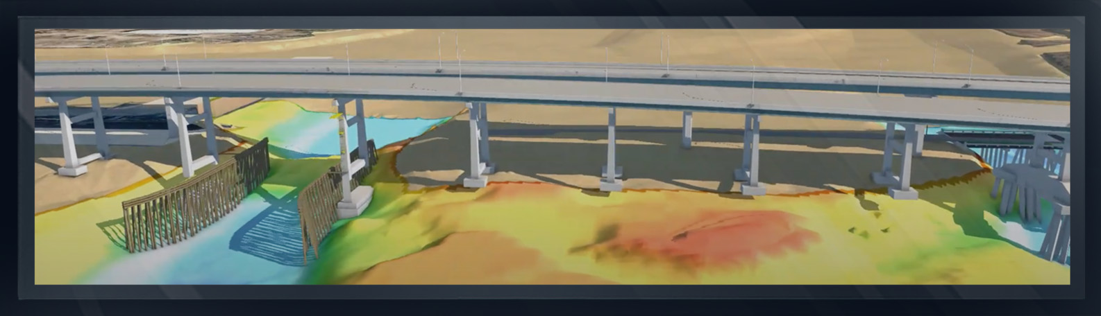
SAN PABLO ATLANTIC BLVD BRIDGE
...
JACKSONVILLE, FLORIDA
BRIDGE SCOUR SURVEY
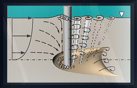
Arc Surveying & Mapping, Inc. and Florida Department of Transportation bridge inspectors formulated a procedure to identify scour at bridge support structures caused by fast moving currents.
Florida is prone to hurricanes, causing tidal surges and potentially undermining the stability of bridges.
Utilizing a Scour Monitoring Program, FDOT stays abreast of river bottom sediment movement and bridge support conditions.
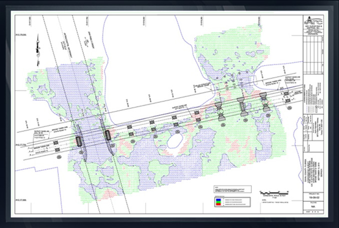
SCOUR MONITORING PLAN

- Establish horizontal and vertical control.
- Perform a baseline multibeam swath depth sounding survey under and 100 ft. each side of the bridge at high tide.
Note: Multibeam swath sounding covers 100% of the riverine surface. Singlebeam bathymetric surveys will suffice in shallow water situations utilizing close line spacing.
- Acquire vessel mounted mobile or static laser scan topographic data of the bridge support structures at low tide.
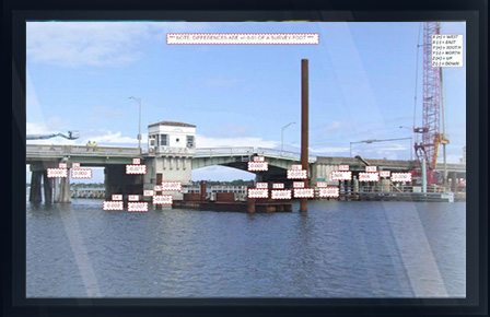
- Merge multibeam bathymetry and laser scan topographic point clouds into a 3D xyz model.
- Generate a color-coded digital terrain model (DTM) of the bathymetricsurface including the bridge support structure. Color coded from shallowest (red) to deepest (dark blue).
- Perform a bathymetric monitoring survey over the same area as the baseline survey.
- Generate a color-coded digital terrain model (DTM) xyz of the monitoring survey.
- Generate an Isopach comparison of the baseline and monitoring surveys identifying areas of erosion in red, areas of incretion in green and areas of no change blue.