
ENVIRONMENTAL REMEDIATION SURVEY
...
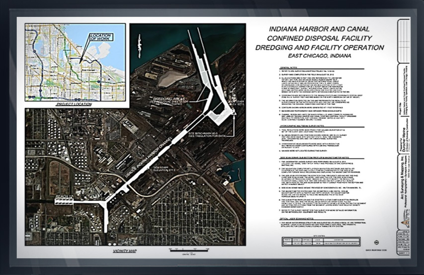
INDIANA HARBOR, CHICAGO, ILLINOIS
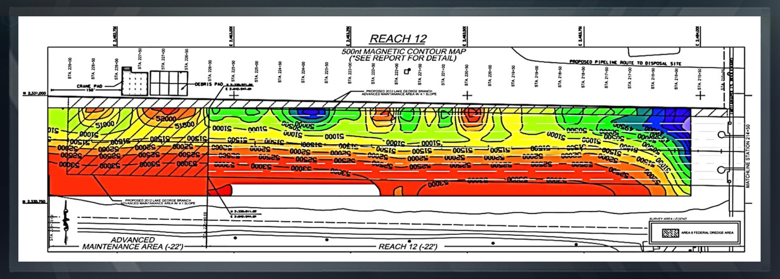
Arc Surveying & Mapping, Inc. performed a bathymetric multibeam swath sonar survey, a side-scan sonar survey, a magnetometer survey, a sub-bottom survey, and a terrestrial optical laser scanning of project waterfront.
This survey provided the contractor with data that covered every aspect of the conditions to be encountered from buried stumps and metal to objects lying on the seafloor such as tires, trees, sunken vessels, etc.

In addition, the terrestrial laser scanning of the shoreline provided a pre-dredge condition of existing docks, bulkheads, seawalls, and other structures.
Contaminated sediment quantities were calculated for payment responsibility of each waterfront corporation, separate from the US government channel responsibility.