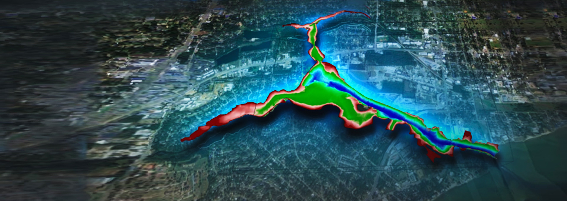
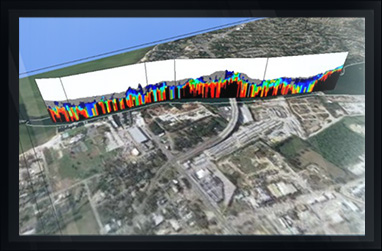
Lakeland, Florida Contaminated Sediment Survey
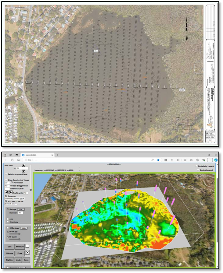
On behalf of AECOM, I would like to commend Arc Surveying and Mapping for their outstanding effort in completing the electrical resistivity surveying and subsurface profiling of Lake Bonnet in Lakeland, FL. This high-profile project, which has received over $42 million in grant funding to reduce flooding, required a comprehensive subsurface profile of the lake's sediments to evaluate the best alternatives.
Your team's technical expertise and extensive knowledge of the dredging industry have been invaluable in helping us visualize the subsurface sediments in an accurate and manageable manner.
I have relied on Arc Surveying and Mapping's expertise for over 20 years and consider them to be one of the best bathymetric and geophysical surveyors in the business. Their commitment to excellence and consistent delivery of high-quality results make them a trusted partner for any surveying and mapping needs.
Dan
Daniel J. Levy, P.G.
Vice President, Environment
National Director / Founder - Algae Practice
M 305.519.1194
dan.levy@aecom.com
AECOM
110 East Broward Blvd
Suite 700
Fort Lauderdale, FL 33317, Country
T 305.519.1194
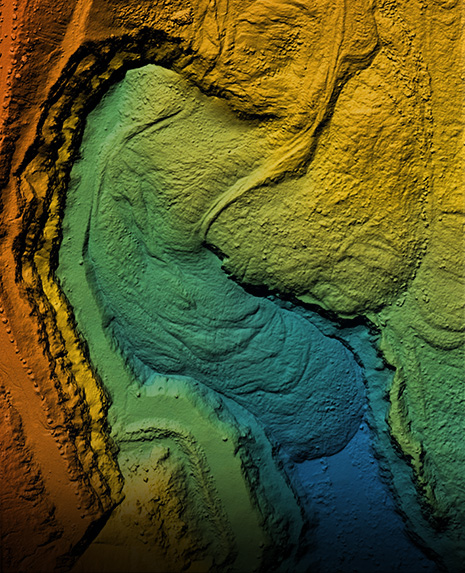
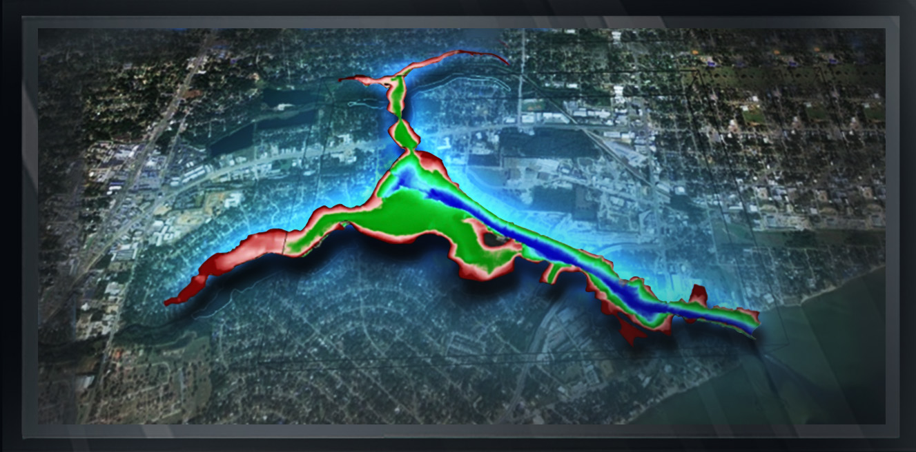
Arc Surveying & Mapping, Inc. provides nationwide bathymetric and geophysical surveys of contaminated marine sediment sites.
Arc provides 3D models illustrating the subsurface geology allowing our clients to select boring locations based on science rather than randomly.
Borings are incorporated into the 3D model, illustrating the geotechnical characteristics of the sediments, including chemical analysis.
Contaminants exceeding EPA or other agency limit requirements are red, and those below-required limits are green.
...
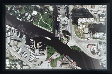
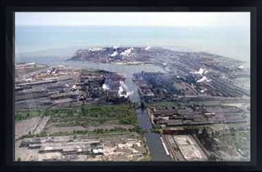
ENVIRONMENTAL PROJECT SAMPLES
CLICK ON IMAGE FOR DESCRIPTION

hydrographic, topographic, geophysical, static and mobile Laser scanning, shoaling surveys, probing, contaminated sediment surveys, acoustic doppler current profiling, quantity calculations, Blueview imagery, side-scan sonar imagery, condition, pre and post dredging surveys, chemical analysis, magnetometer surveys, deformation, emergency, structural monitoring, crane measurements, berth surveys, drone (UAV) LiDAR, video and photogrammetric inspection surveys, 3D Interactive modeling, asset management, geographic Information systems, GIS, AutoCAD, MicroStation