April 21, 2025
Surveying plays a vital role in infrastructure, construction, and environmental management. But when it comes to choosing the right method, many decision-makers ask: LiDAR vs. Traditional […]
April 10, 2025
Ports and harbors play a crucial role in global trade and transportation. To keep these waterways functional and safe, regular maintenance is essential. One of the […]
March 18, 2025

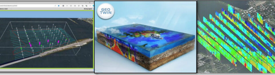
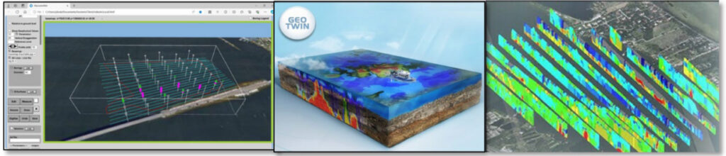
Construction projects often involve digging, drilling, and excavation. Hitting underground utilities can cause delays, safety risks, and expensive repairs without proper planning. This is where Subsurface […]
March 10, 2025

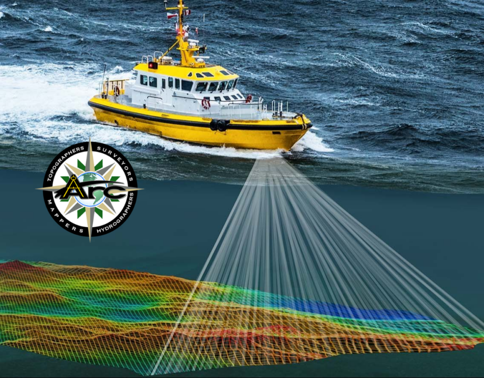
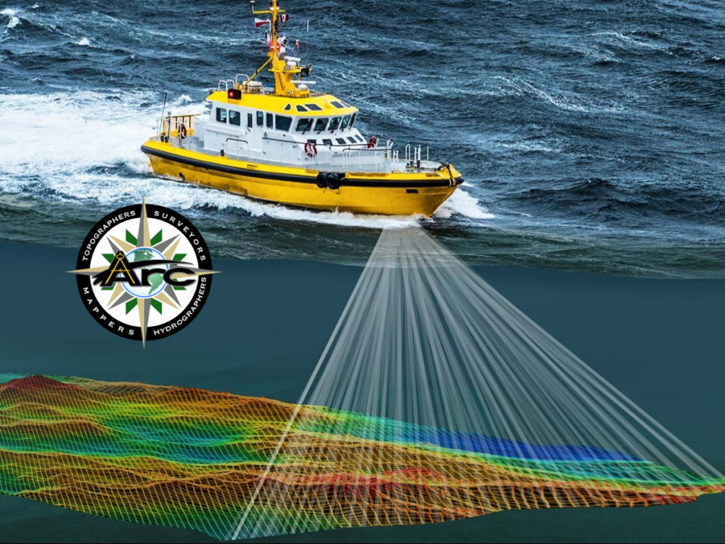
Hydrographic surveys are essential for navigation, marine construction, and environmental monitoring. Traditional methods require time-consuming and costly efforts. Now, with Multi-Beam Sonar Technology, hydrographic surveys are […]
February 25, 2025

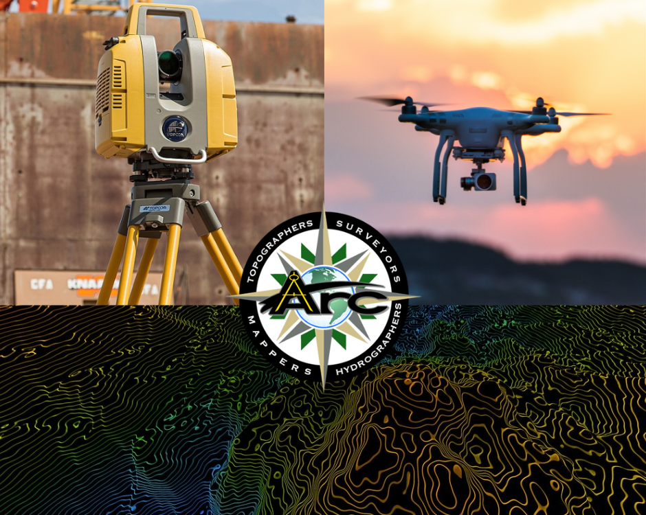
Surveying and mapping have evolved significantly over the years. With the rise of remote sensing, professionals can now gather accurate data faster than ever. This technology […]
January 29, 2025

AI-Powered Surveying: What the Future Holds for Data Analysis Artificial intelligence (AI) is transforming the surveying industry. From land surveys to hydrographic mapping, AI enhances efficiency, […]
June 17, 2024
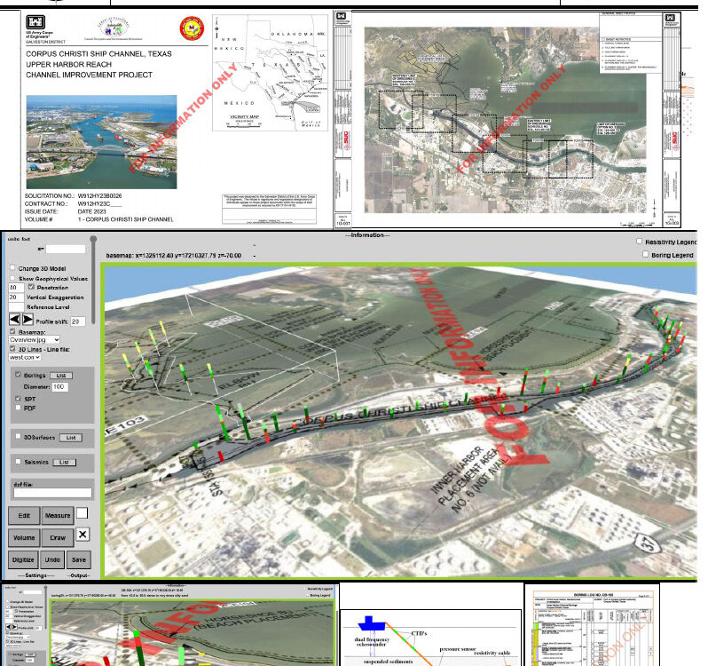
Arc Surveying & Mapping, Inc. offers new subsurface surveying technology that identifies 100% of the materials to be excavated The Galveston District US Army Corps of […]
May 30, 2024
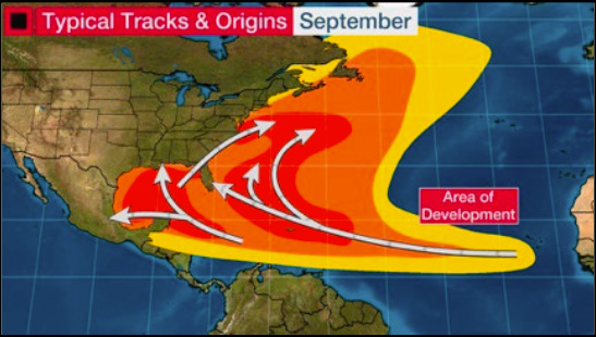
Based on current forecasts, Arc Surveying & Mapping, Inc. of Jacksonville, Florida anticipates an increase of emergency hydrographic and topographic surveys during the 2024 Hurricane Season. […]
May 2, 2024
As environmental restoration projects gain momentum, precision becomes paramount. In the case of the Eau Gallie A1 Muck Removal Project, meticulous surveying is essential to ensure […]