Ports and harbors play a crucial role in global trade and transportation. To keep these waterways functional and safe, regular maintenance is essential. One of the most effective tools for this maintenance is bathymetric surveying. This specialized technique helps assess underwater conditions, ensuring safe navigation and structural integrity.
What Are Bathymetric Surveys?
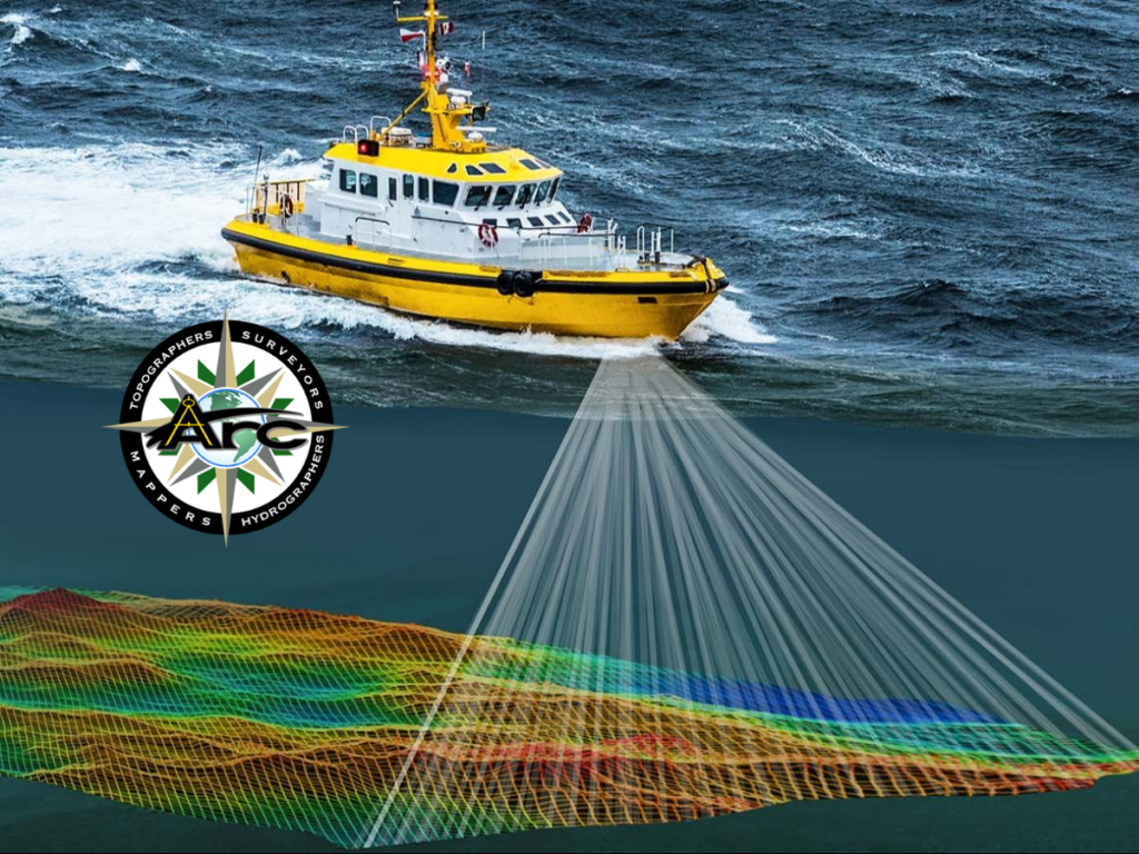
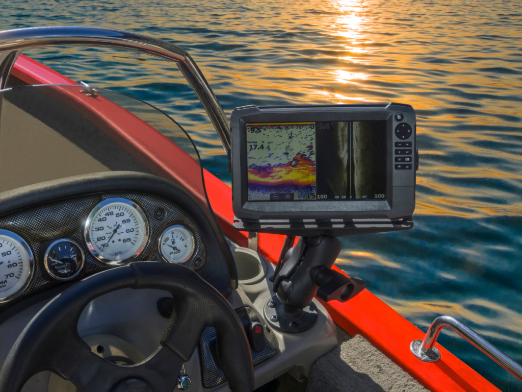
Bathymetric surveys, also known as hydrographic surveys, measure the depth and topography of water bodies. Using advanced sonar technology, these surveys create detailed maps of the seafloor. They help identify sediment buildup, underwater hazards, and changes in depth that may affect maritime operations.
Why Are Bathymetric Surveys Important for Port and Harbor Maintenance?
1. Ensuring Safe Navigation
Ships require a specific depth to operate safely. Bathymetric surveys detect underwater obstructions, sandbars, and sediment accumulation that could pose risks to vessels. By providing accurate depth measurements, these surveys help port authorities maintain safe and efficient navigation channels.
2. Managing Sediment Accumulation
Sediment buildup is a common issue in ports and harbors. This can reduce water depth, making it difficult for large vessels to dock. Bathymetric surveys monitor sediment levels, allowing authorities to plan dredging operations efficiently. This proactive approach prevents unexpected delays and costly emergency dredging.
3. Assessing Structural Integrity
Docks, piers, and seawalls face constant exposure to water currents, tides, and sediment movement. Over time, these structures may weaken or become unstable. Bathymetric surveys help detect erosion, scouring, or structural damage beneath the water’s surface. This data is essential for planning repairs and ensuring the longevity of port infrastructure.
4. Supporting Environmental Compliance
Ports must comply with environmental regulations to protect marine ecosystems. Bathymetric surveys help monitor changes in underwater habitats, assess the impact of dredging, and ensure that maintenance activities follow environmental guidelines. This is especially important for preventing habitat destruction and maintaining water quality.
5. Optimizing Port Expansion and Development
As global trade increases, ports must expand to accommodate larger vessels and higher cargo volumes. Bathymetric surveys provide essential data for planning new docks, channels, and terminals. Engineers use this information to design structures that are both safe and sustainable.
Technologies Used in Bathymetric Surveys
Modern bathymetric surveys use advanced technologies to collect precise data. These include:
- Single-beam sonar – Measures depth at specific points, ideal for small-scale surveys.
- Multibeam sonar – Captures a wider area, providing detailed 3D seafloor maps.
- Lidar (Light Detection and Ranging) – Uses laser pulses for high-resolution depth measurements, often combined with aerial surveys.
- Side-scan sonar – Creates detailed images of the seafloor, useful for detecting underwater objects.
The Process of Conducting a Bathymetric Survey
- Planning: Identify the survey area, determine the required resolution, and select appropriate equipment.
- Data Collection: Use sonar or lidar technology to map the seafloor.
- Data Processing: Convert raw measurements into detailed charts and maps.
- Analysis and Reporting: Assess findings, identify hazards, and recommend maintenance actions.
The Future of Bathymetric Surveys in Port Maintenance
Advancements in technology continue to improve bathymetric surveying. Autonomous underwater vehicles (AUVs) and unmanned surface vessels (USVs) are making data collection faster and more cost-effective. Additionally, real-time monitoring systems help ports track changes continuously, allowing for quicker responses to sediment buildup or structural issues.
Conclusion
Bathymetric surveys are essential for maintaining safe and efficient ports and harbors. They provide critical data for navigation, sediment management, structural assessments, environmental compliance, and expansion planning. As technology evolves, these surveys will become even more precise and efficient, ensuring the long-term sustainability of maritime infrastructure.
For expert bathymetric surveying services, trust Arc Surveying & Mapping, Inc.. With over 35 years of experience, we provide accurate and reliable surveying solutions to support port and harbor maintenance.
External Reference: For more insights on bathymetric surveys and their role in maritime safety, visit the National Oceanic and Atmospheric Administration (NOAA).